


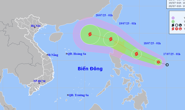
A map shows the projected locations and path of a tropical depression near the East Vietnam Sea as of 1:00 am on July 17, 2025. Photo: Vietnam’s National Center for Hydro-Meteorological Forecasting
As of 7:00 am on Thursday, the tropical depression was located over the eastern waters of the Philippines, with sustained winds at level 7 (50-61kph) on the Beaufort scale and gusts up to level 9 (75-88kph).
In the next 24 hours, the system is forecast to move west-northwest at 15-20kph and strengthen into a tropical storm with winds at level 8-9 (62-88kph) and gusts at level 11 (103-117kph).
By 7:00 am on Friday, it could be located over eastern Luzon Island in the Philippines.
It is projected to cross northern Luzon and enter the East Vietnam Sea by early Saturday, potentially becoming the third storm to hit the maritime area this year.
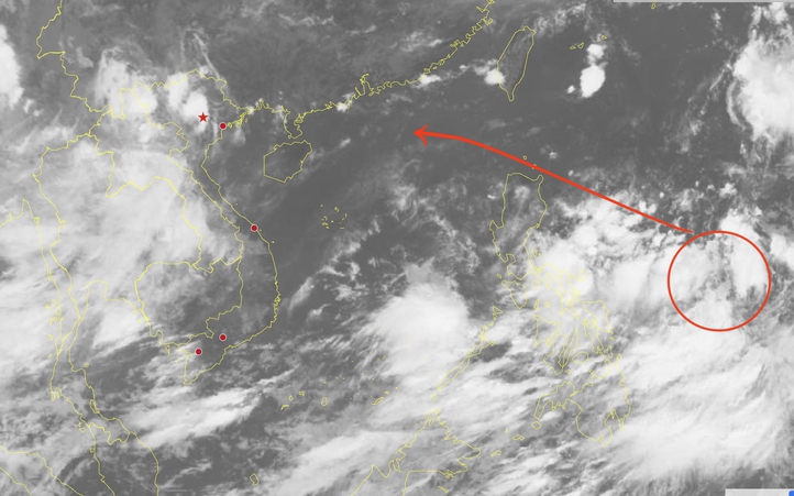
By 7:00 am on Saturday, it may maintain the west-northwest direction at a faster speed of 25kph, packing winds at level 10 (89-102kph) and gusts at level 12 (118-133kph).
According to the national weather agency, there is a 60-percent chance it will head toward the Gulf of Tonkin and northern Vietnam’s mainland.
If this path holds, heavy widespread rainfall could affect the northern provinces and areas from Thanh Hoa to Nghe An between July 20 and 25.
Authorities urge coastal communities, maritime operations, and the public to monitor updates closely and prepare for all scenarios.
